
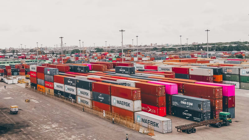
Mombasa moves cargo. Mombasa moves people. And increasingly, Mombasa moves data. But for years, fleet operators on the Kenyan Coast have had to make do with tracking solutions designed for Nairobi's roads and Nairobi's problems. The result? Gaps in coverage, hardware that struggles with coastal humidity, and platforms that have no concept of port access zones, the Likoni Ferry corridor, or the cross-border complexity of SGR-linked logistics routes heading south to Tanzania and north toward Uganda via the coast road. Coastal businesses are not a footnote in Kenya's logistics story. They are a chapter of their own. And the smartest operators on the Coast are now demanding fleet tracking tools built for their reality.
The Unique Challenges of Fleet Operations on the Kenyan Coast
Running a fleet in Mombasa is not the same as running one in Nairobi or Nakuru. The operating environment is fundamentally different, and those differences have real implications for how GPS tracking technology must perform.
Salt air and coastal humidity are hard on electronics. Trackers installed on trucks operating in and around Mombasa port, on ferries crossing at Likoni, or on refrigerated vehicles hauling fish from Malindi are exposed to conditions that degrade cheap hardware fast. A tracker that works fine in the dry Central Highlands may fail within months on a vessel deck or inside a container yard near the ocean. Hardware durability is not a minor specification detail. It is a make-or-break factor for Coast-based operators.
Port access is another layer entirely. Kenya Ports Authority controls movement in and around the Kilindini Harbour area with its own protocols. Fleet managers need to know when vehicles enter and exit restricted zones, how long trucks are sitting in the port waiting for loading or off-loading, and whether drivers are deviating from approved routes inside the facility. Generic tracking platforms often lack the geofencing granularity to support this kind of oversight.
Then there is the cross-border dimension. Many Mombasa-based logistics operators run vehicles to Dar es Salaam, Tanga, or Arusha through Tanzania. Others move cargo through the Northern Corridor into Uganda. Tracking visibility across these routes requires robust network coverage and a platform capable of presenting cross-border movement in a clear, actionable format. Losing a vehicle at the border is not just an operational inconvenience. It is a serious security and compliance risk.
Who Is Adopting GPS Tracking in Mombasa Right Now
The demand for fleet tracking on the Coast is growing fast, and it is not coming from a single industry. Several distinct business types are driving adoption.
Port logistics companies and clearing agents are at the front of the queue. These businesses operate trucks that move containers from the port to inland depots, bonded warehouses, and distribution hubs. They are accountable to clients for delivery timelines and to KRA for cargo integrity. Real-time tracking gives them the proof of movement they need and the fuel accountability that keeps costs honest on high-mileage port runs.
Tour and safari operators based in Mombasa, Diani, Kilifi, and Malindi manage fleets of minibuses, 4x4 safari vehicles, and shuttle coaches. Guest safety is non-negotiable. Knowing where every vehicle is at every moment, whether a driver is speeding on the Malindi highway, or whether a vehicle has broken down between Kilifi and Watamu, is not a luxury. It is a liability management essential. Parents booking school trips and hotel guests booking transfers expect operators to have this level of control.
Distribution businesses serving the Coast region face their own pressures. Cold chain operators moving dairy, pharmaceuticals, and fresh produce from Mombasa northward along the coast road to Malindi and beyond need temperature-aware fleet management. FMCG distributors covering routes through Mariakani, Voi, and down to the Tanzania border need route adherence monitoring and driver behaviour data. Without GPS visibility, fuel theft and unauthorised stop-overs quietly drain margins on every route.
Construction and heavy equipment companies operating around Mombasa's expanding infrastructure corridor also represent a significant segment. Equipment running on SGR-adjacent construction sites, road rehabilitation projects along the coast, and port expansion works needs asset tracking as much as fleet tracking. Knowing that an excavator or generator has moved off-site without authorisation is the kind of alert that saves hundreds of thousands of shillings.
What the SGR Corridor Means for Fleet Tracking Demand
The Standard Gauge Railway has restructured cargo flow into and out of Mombasa in ways that create new fleet management requirements. Inland Container Depots in Nairobi, Naivasha, and eventually beyond have not eliminated road transport from the Coast. They have changed its character. Short-haul container movements between Mombasa port and the Mombasa ICD, drayage to bonded facilities, and last-mile delivery from SGR hubs to final consignees all require precise vehicle tracking.
For a clearing agent managing ten trucks doing port-to-ICD runs, a GPS platform that shows dwell time, trip duration, idle time, and fuel consumption per trip is the difference between a profitable operation and one that bleeds money on inefficiency. The SGR corridor has raised the bar for logistics professionalism on the Coast. Fleet tracking is part of meeting that bar.
You can explore how fleet management solutions from Trackalways Africa are structured to support exactly these kinds of high-frequency, high-accountability operations.
What to Look for in a Fleet Tracking Provider That Covers the Coast
Not every tracking provider can serve Mombasa well. Here is what Coast-based businesses should demand before signing any contract.
Hardware rated for marine and high-humidity environments matters. Ask about IP ratings and whether the trackers have been deployed successfully in coastal logistics contexts. A provider that cannot answer this question confidently has not done the work.
Network coverage along the coast road, through Kilifi, Malindi, and into the less-populated stretches toward Lamu, must be verified. Coverage maps should be specific. Broad claims about national coverage mean nothing if your vehicles go dark between Gongoni and Mambrui.
Cross-border tracking capability is essential for operators running into Tanzania or Uganda. The platform must support visibility across borders, and the provider must have a plan for what happens when a vehicle is in low-signal territory near the border.
Geofencing for port zones and restricted areas should be available and configurable without needing to call a support line. Self-service geofence creation on an intuitive platform is a sign that the software was built with real operational needs in mind.
Fuel monitoring deserves special attention. Mombasa's fuel prices and the long distances trucks cover on Coast-region routes make fuel the largest controllable cost in most fleets. A provider offering integrated fuel monitoring with sensor-level accuracy gives operators the data they need to identify theft, calculate real cost-per-kilometre, and hold drivers accountable.
Finally, local support presence matters. A helpline that works and a team that understands Mombasa's logistics environment means problems get solved in hours, not days.
How Trackalways Africa Serves Clients Beyond Nairobi
Trackalways Africa is not a Nairobi-only company. We support fleet operators across Kenya, including businesses headquartered in Mombasa, Kilifi, Malindi, and along the entire coastal corridor. Our Venus Platform is designed for operators who need real-time visibility, actionable reports, and reliable alerts regardless of where their vehicles are operating.
Our hardware portfolio includes trackers rated for demanding environments. Coastal operators working in high-humidity conditions, port yards, and marine-adjacent routes can rely on devices that are built to last. Our advanced trackers offer the connectivity and durability that Mombasa's operating conditions require.
For fleet operators concerned about cargo security on high-risk routes, our Titan Smart E-Lock product provides an additional layer of container and cargo protection. Paired with GPS tracking, it gives clearing agents and logistics companies documented proof of cargo integrity from port to final destination. Learn more about the Titan Smart E-Lock and how it fits into a Coast-region logistics operation.
We also support video telematics for operators who need event-triggered footage, driver behaviour scoring, and incident documentation. For tour operators in Diani or Malindi, this is the tool that manages driver accountability on guest-carrying vehicles in a way that no amount of manual supervision can replicate.
Our team is reachable directly at +254 116 257285 and through trackalwaysafrica.com. If your fleet operates on the Coast and your current tracking setup is not delivering the visibility you need, the conversation starts there.
The Bottom Line for Mombasa Fleet Operators
The Coast is not a secondary market. Mombasa is Kenya's largest port, its second city, and a logistics gateway for the entire East African region. Businesses operating here deserve tracking technology that matches their environment, their routes, and their operational complexity. Generic solutions installed by providers who have never navigated a port access zone or mapped a Malindi-to-Mombasa route in coastal heat will not cut it.
The smartest fleet operators on the Coast are already making the switch. They are reducing fuel waste, recovering stolen vehicles faster, improving driver discipline, and giving their clients the shipment visibility that modern logistics demands. The question is not whether GPS tracking is worth it in Mombasa. The question is how much longer you can afford to operate without it.
Get in touch with Trackalways Africa today. Call +254 116 257285 or visit trackalwaysafrica.com to speak with a team that understands what fleet management on the Kenyan Coast actually looks like.
Frequently Asked Questions
Does GPS tracking work reliably in and around Mombasa port?
Yes, with the right hardware and platform. Trackalways Africa deploys trackers that maintain signal integrity in port environments. Our platform supports custom geofencing for restricted zones like Kilindini Harbour, so you know exactly when vehicles enter and exit designated areas. Port dwell time reporting is available as a standard feature.
Can I track vehicles that cross into Tanzania or Uganda from Mombasa?
Absolutely. Cross-border tracking is a core capability for logistics operators on the Coast. Our platform maintains visibility as vehicles move through the Tanzania border at Lunga Lunga and along Northern Corridor routes. Coverage continuity in border zones is something we verify before deployment for any client running cross-border operations.
Will coastal humidity damage the GPS trackers installed on my vehicles?
It depends entirely on the hardware. Cheap trackers with low ingress protection ratings will degrade in Mombasa's coastal humidity. Trackalways Africa specifies hardware appropriate for the operating environment of each client. For coastal deployments, we use trackers with the environmental ratings needed to perform reliably over multi-year installation periods.
How does fuel monitoring help fleets operating on long Coast-region routes?
Long haul routes between Mombasa, Malindi, Kilifi, and cross-border destinations are high-exposure environments for fuel theft and inefficiency. Sensor-based fuel monitoring from Trackalways Africa tracks actual fuel levels in real time, flags suspicious drops, calculates consumption per trip, and gives fleet managers the data to separate genuine operational costs from losses due to theft or driver misconduct. On routes of this distance, the savings are substantial.